In today’s digital age, understanding “what is geotag” and how to apply it to images can bring many amazing benefits. So don’t miss the article below to understand geotag tools and how to geotag photos accurately and optimally.
What is Geotag?
Geotagging is the process of adding location or geographic information to images, videos, or other media on a website. This allows search engines and applications to identify the exact location of the content, thereby providing more relevant search results to users. This location information includes various parameters such as:
- Latitude: This value allows search engines to determine an exact location based on latitude lines, indicating whether the point is north or south of the Equator.
- Longitude: This value helps determine the location in the East or West direction through the meridians.
- Altitude: This parameter determines the altitude of the photo location relative to sea level, increasing the accuracy of geolocation.

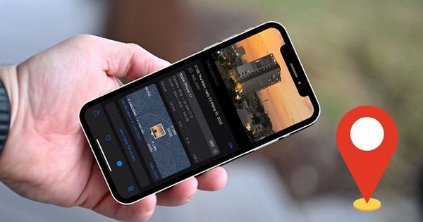
Geotag is attaching location or positioning information to images on the website.
3 Geotag Locations
#1. Geotag your images
Image geotagging is the practice of adding geographic information to image files, usually through metadata. When a photo is taken with a device that has GPS capabilities, information about the latitude, longitude, and sometimes altitude is automatically added to the image file. This information can be used to display the photo on a map or to search for photos based on location.
#2. Geotag your blog
Blog posts can also be geotagged to link content to a specific location. This is useful for posts related to events, tourist attractions, or any topic closely related to a geographic location. It increases the likelihood of the post appearing in local search results and provides a richer user experience.
<h3style=”text-align: justify;”>#3. Geotag on HTML
Geotags can be embedded directly in a website’s HTML code, allowing browsers and search engines to understand the geographic location of a website. This can enhance local SEO and help your website appear more accurately in location-based search results.

Geotagging can be mounted on many different platforms and formats.
Benefits of Geotagging
Geotagging offers many significant benefits, from improving SEO performance to enhancing user experience:
#1. Improve SEO effectiveness
Geotags help optimize SEO by adding geographic information, making images more relevant to specific search queries. This not only helps images rank higher in search results, but can also improve a website’s overall ranking on the SERP.
In addition, high-quality images are easily used as references by other websites. Thanks to that, businesses can build a backlink system and mention their Brand naturally and for free without having to spend too much effort but still ensuring high quality.
#2. Increase website traffic
Organic traffic sources greatly support website optimization. When images are geotagged, they can appear at the top of search results on Google or other search engines, leading to increased traffic from local queries. This is especially important for businesses that want to attract customers in the area. That is why businesses in the hotel, interior, culinary, etc. fields are very concerned about the aesthetics of the website.
#3. Increase visibility and brand awareness
Geotags help search engines pinpoint the exact location of your business, thereby increasing the visibility of your products and services in search results. If your website appears in high positions, customers will have more confidence in the credibility and transparency of your brand and have a better impression.
#4. Optimize user experience
Geotagging also improves user experience by providing valuable geographic information that helps customers find content relevant to their location or places of interest. Local SEO is now being implemented by many businesses because users now tend to search “find location by image”.
Not only does this make it easier for users to find information, it also increases the likelihood of interacting with that content. Additionally, appropriate geotagging also improves page load speed, enhancing the user experience.
#5. Increase conversion rates
Compared to written content, images are more likely to attract customers because of their visual and aesthetic qualities. Text keywords have extremely high competition density, so many brands choose to optimize images to increase customer reach. At the same time, Geotagging also helps position your content in the right place for the target audience, thereby increasing the conversion rate of marketing campaigns.

Geotagging helps increase website rankings on search engines, optimizing user experience
3 popular image geotag tools today
Nowadays, there are many tools that can effectively support marketers in the process of Geotagging:
- GeoSetter: GeoSetter is a versatile tool that allows users to edit and manage geodata of image files. It can display existing geotags with links to Google Maps, and even edit tags if needed. Its strengths are the ability to read and write Exif, IPTC, and XMP metadata formats.
- Exif Pilot: Exif Pilot is primarily an EXIF data editor but also supports geotag editing in digital photos. This tool allows users to view, create, and edit EXIF, EXIF GPS, and IPTC data.
- Adobe Lightroom: Adobe Lightroom offers geotagging capabilities through its map module, allowing users to drag and drop photos onto a map to assign locations. While not completely free, Lightroom offers a free trial to explore its features.

Geotag tools help businesses optimize images more quickly and effectively.
Instructions for geotagging images using GeoSetter software
Below, MarkKnow will guide you through the detailed steps on how to geotag photos using GeoSetter software, which is extremely simple but extremely effective:
Step 1: Download and install GeoSetter software
Download the GeoSetter software from the official website. Follow the instructions to install it. This software only supports Windows, so if you use MacOS, you may need a solution like a virtual machine or find other compatible software.

Download and install GeoSetter
Step 2: Open GeoSetter and load the image to be geotagged
Open GeoSetter and use the “Open” feature to select the image you want to geotag. The image will load into GeoSetter and display the existing information. Next, right-click and select “Edit Data”.

Select and upload photos to geotag
Step 3: Geotag the image
If you know the exact coordinates, you can enter the latitude and longitude directly in the “Location” section of the image. Next, you can fill in additional information like the image below like MarkKnow:

Fill in the information about longitude and latitude
After completing the information in the “Location” tab, you can click on the “Source/Description” tab and fill in more information about “Artist”, “Source”, “Credit”, “URL” of your brand.

Fill in information about the author, source and copyright of the image.
Step 5: Save and confirm geotag information
Once geotagged, select “Save as Template”. GeoSetter will update the image metadata with the new location.

Save geotagged photos
You can customize the information included in the geotag image. Review it and click “OK” when finished.

Geotag information options
Step 6: Use and share geotagged images
The geotagged image will display red stars, then press “Ctrl+S” to complete. The finished image will display yellow stars.

Final image after geotagging
In the computer folder, there will be 2 image files, in which the Original file is the image without geotag. When uploading to the website, choose the image WITHOUT the original extension to optimize website SEO better.

Use Geotagged Images
Conclude
Understanding what geotags are will help businesses maximize the benefits of geotagging to increase customer conversion and increase brand revenue. With the support of online and traditional geotag tools, geotagging becomes quick, easy, and expands the ability to promote locations related to your image in an impressive way.
Comment Policy: We truly value your comments and appreciate the time you take to share your thoughts and feedback with us.

Note: Comments that are identified as spam or purely promotional will be removed.

To enhance your commenting experience, consider creating a Gravatar account. By adding an avatar and using the same e-mail here, your comments will feature a unique and recognizable avatar, making it easier for other members to identify you.

Please use a valid e-mail address so you can receive notifications when your comments receive replies.